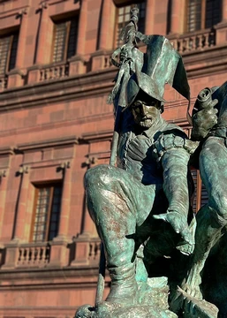
Willem Janszoon
Dutch navigator who made first recorded European landfall in Australia.

Wikipedia / Wikimedia Commons
Willem Janszoon (c. 1570 – c. 1630) was a Dutch navigator and colonial governor who served in the Dutch East Indies. He is best known for commanding the Duyfken during the 1605–1606 voyage that resulted in the first recorded European landfall on the coast of Australia.
- born
- c. 1570
- died
- c. 1630
- field
- Navigation, colonial governance
- nationality
- Dutch
- known_for
- First recorded European landfall on the Australian continent (1606)
Lore & Background
Willem Janszoon was born around 1570, the son of Jan, but nothing more is known of his early life. He first appears in records in 1598 as a mate aboard the Hollandia, part of a Dutch fleet to the East Indies. He later commanded the Duyfken, a small ship dispatched from Bantam on 18 November 1605 (Julian calendar) to explore New Guinea and other southern lands. The ship's log is lost, but his chart survives, showing a route through the Banda Islands, Kai Islands, Aru Islands, and western New Guinea before crossing the Arafura Sea into the Gulf of Carpentaria. On 26 February 1606, Janszoon made landfall at the Pennefather River on Cape York, Queensland—the first recorded European landfall on Australia. He charted about 320 km of coastline, believing it to be a southerly extension of New Guinea. Conflict with Aboriginal people led to the deaths of nine crew members, and Janszoon returned to Banda by June 1606, calling the land Nieu Zelant after the Dutch province of Zeeland, though the name was later used for New Zealand.
Reader's Guide
Willem Janszoon's 1606 voyage marks the first documented European encounter with the Australian continent, predating later Dutch and British explorations. Although his log is lost, the Duyfken chart survived and was used by cartographer Hessel Gerritszoon in 1622 to produce the first map containing any part of Australia. The chart later ended up in the Imperial Library in Vienna, forgotten for two centuries. Janszoon's belief that the land was connected to New Guinea led to a cartographic error that persisted for years. His later career included service as governor of Banda and involvement in diplomatic and military actions against the British East India Company. The violent encounters with Aboriginal people during his voyage set a precedent for early European–Indigenous contact in Australia. The uncertainty around the exact sequence and location of the nine deaths, as recorded in conflicting accounts, highlights the fragmentary nature of the historical record.
Did You Know?
- Janszoon's ship Duyfken was in Torres Strait in February 1606, months before Spanish explorer Luís Vaz de Torres sailed through it.
- The name 'Nieu Zelant' he gave to the land was later used by Dutch cartographers for New Zealand.
- The Duyfken chart was still in existence around 1670 and was copied; the copy remained forgotten in Vienna's Imperial Library for two hundred years.
- Janszoon was awarded a gold chain worth 1,000 guilders in 1619 for capturing four British East India Company ships.
More in Explorers & Conquistadors 1-20
Spotted an error? Know more?
This is a living reference — every entry is fact-audited, and reader corrections feed straight into our audit queue. Suggest an edit · See this site's audit record